SonaSoft 4.2 Update Available

Overview
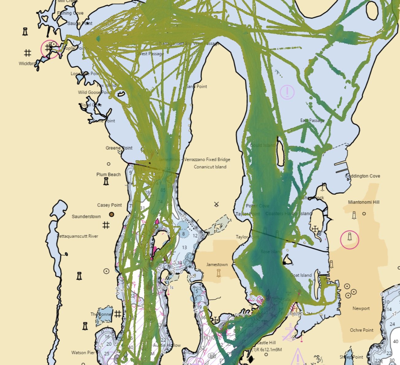
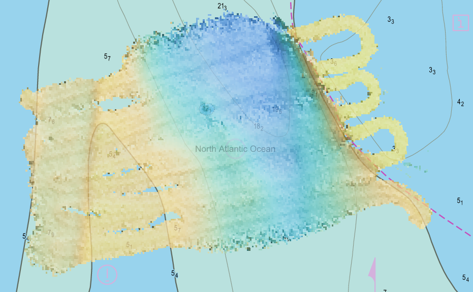
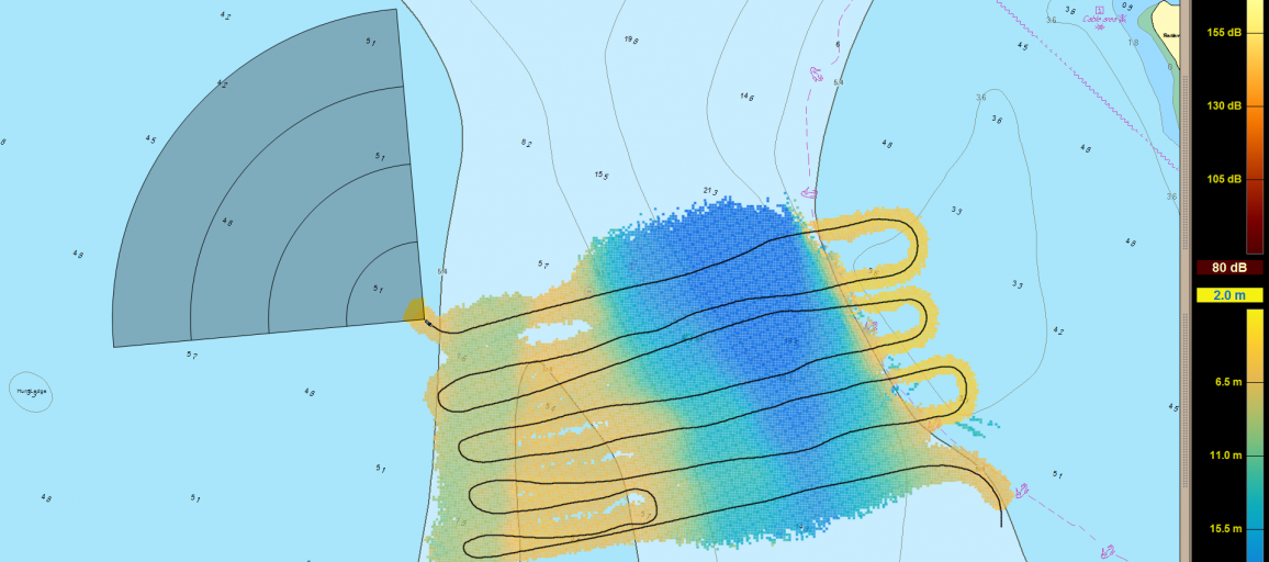
Local History Mapping™ data can now be backed up to FarSounder’s data server and shared anonymously across the FarSounder fleet for the benefit of other users and global data ocean data initiatives. This release also adds the ability to report observations of marine mammals or other navigation hazards in SonaSoft. Reported observations will be shared anonymously with marine mammal and ocean debris tracking organizations for the benefit of ocean science and all mariners.
This release also brings a host of internal and tooling updates that translate into a more robust and overall higher performing system. You'll also find a number of smaller tweaks to the interface that should make your FarSounder experience more enjoyable including improved support for high resolution displays.
In case you haven’t heard:
SonaSoft 4.1 enabled users to share their Local History Mapping (LHM) with other users as well as contribute data collected to the Seabed 2030 project via the Datacenter for Digital Bathymetry Crowdsourced Database at NOAA. This builds on top of the recent changes in SonaSoft 4.0 to add the display of Local History Mapping (LHM) to the 3D Viewer, an Auto Zoom mode that lets the user focus on the 3D Range of the system in the 3D Viewer, and other UI updates and improvements.
SonaSoft 3.17 added support for storing Local History Mapping (LHM) data indefinitely when disk space permits and tide correction is available (via an Admiralty TotalTide subscription). The display of LHM and 3D data was also improved to help highlight features in the bottom detection. Finally, the chart display was modified to show tide station locations as part of the Total Tides integration.
Other Recent Updates
If it has been a while since you last updated, here are some highlights of the other recent user facing improvements we have made to the system over the last few releases:
Implemented NMEA over ethernet support.
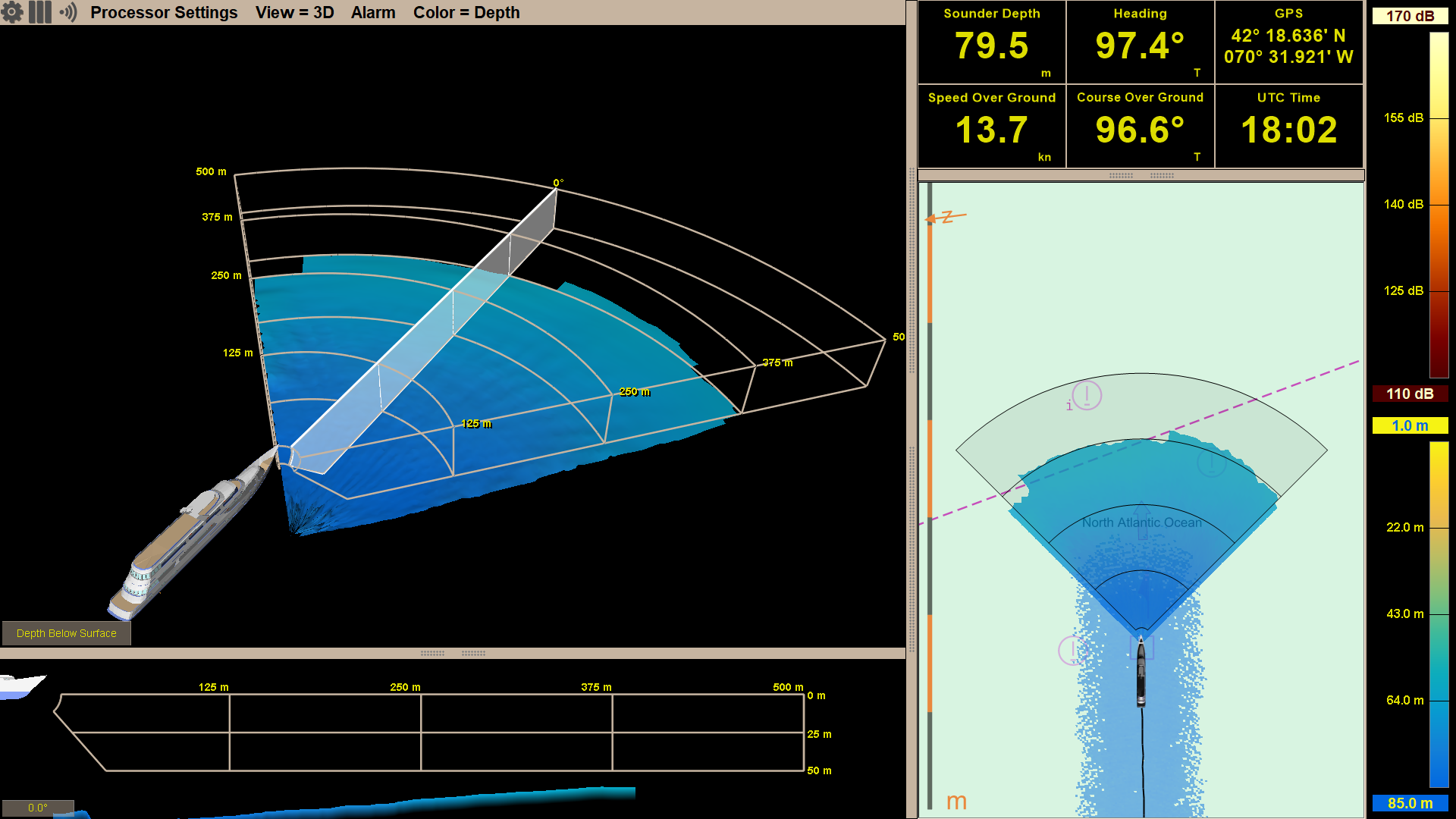
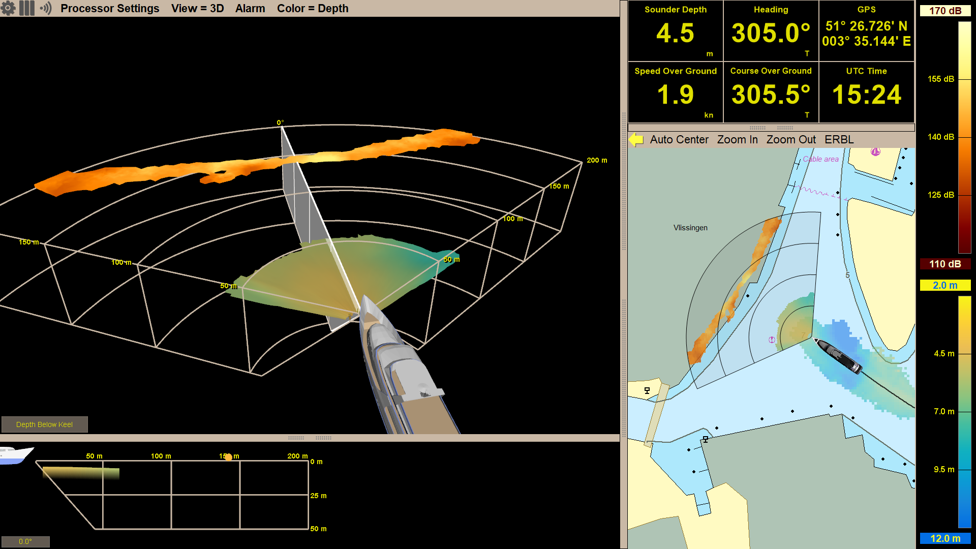
Auto Zoom mode in the 3D Viewer - automatically scale vertical viewer range to the current seafloor depth for maximum resolution
Local History Mapping data in the 3D Viewer
Blog explaining chart import options
Bottom detections to 85m (instead of 50m) depending on environment
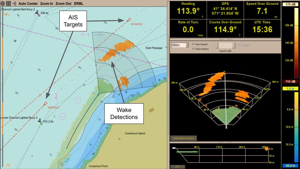
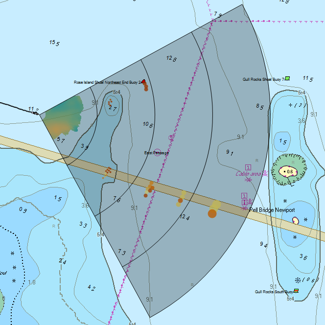
Support for AIS and ARPA tracks in the Chart View.
Introduced a system troubleshooting guide to help technicians when servicing the system.
Added a Standby mode, in which the system remains active but uses a blank ping which does not transmit a signal. 3.12 also included some updates to the Signal Quality indicator in situations with wakes or other large bubble fields.
Added a short introductory video that covers the basics of the FarSounder system as well as complimentary End User Training.
Products Affected
Current: Argos 350, Argos 500, and Argos 1000 sonars
Note: Argos 500 and Argos 1000 are formerly known as the FarSounder-500 and FarSounder-1000
Computer Requirements
The new features are computationally intensive and stringent computer specifications are required in order to maintain a fast update rate. The recommended computer specifications for our Argos 350, Argos 500, and Argos 1000 sonars are posted on our web site. Running this software update on lesser powered computers may result in slow update rates.
IMPORTANT: This release requires Microsoft Windows 10 Pro 64 bit (US Version). Customers running Windows 7 will need to upgrade their operating system first.
NMEA Requirements
Additionally, in order to take full advantage of this update the following vessel navigation sensors inputs are required via NMEA:
True Heading @ 1Hz minimum (gyro or gps compass)
Rate of Turn @ 10Hz minimum (gyro or gps compass)
Speed Over Ground @ 1Hz minimum (gps)
Position @ 1Hz minimum (gps)
Course @ 1Hz minimum (gps)
Depth Below Vessel @ 1Hz minimum (echosounder)
AIS
ARPA
How to Receive Service
This standard upgrade is complimentary. If you only need the software update, please fill out our software update request form.
We have also created a guide to walk through each step of the software installation.