
News
Search our News:
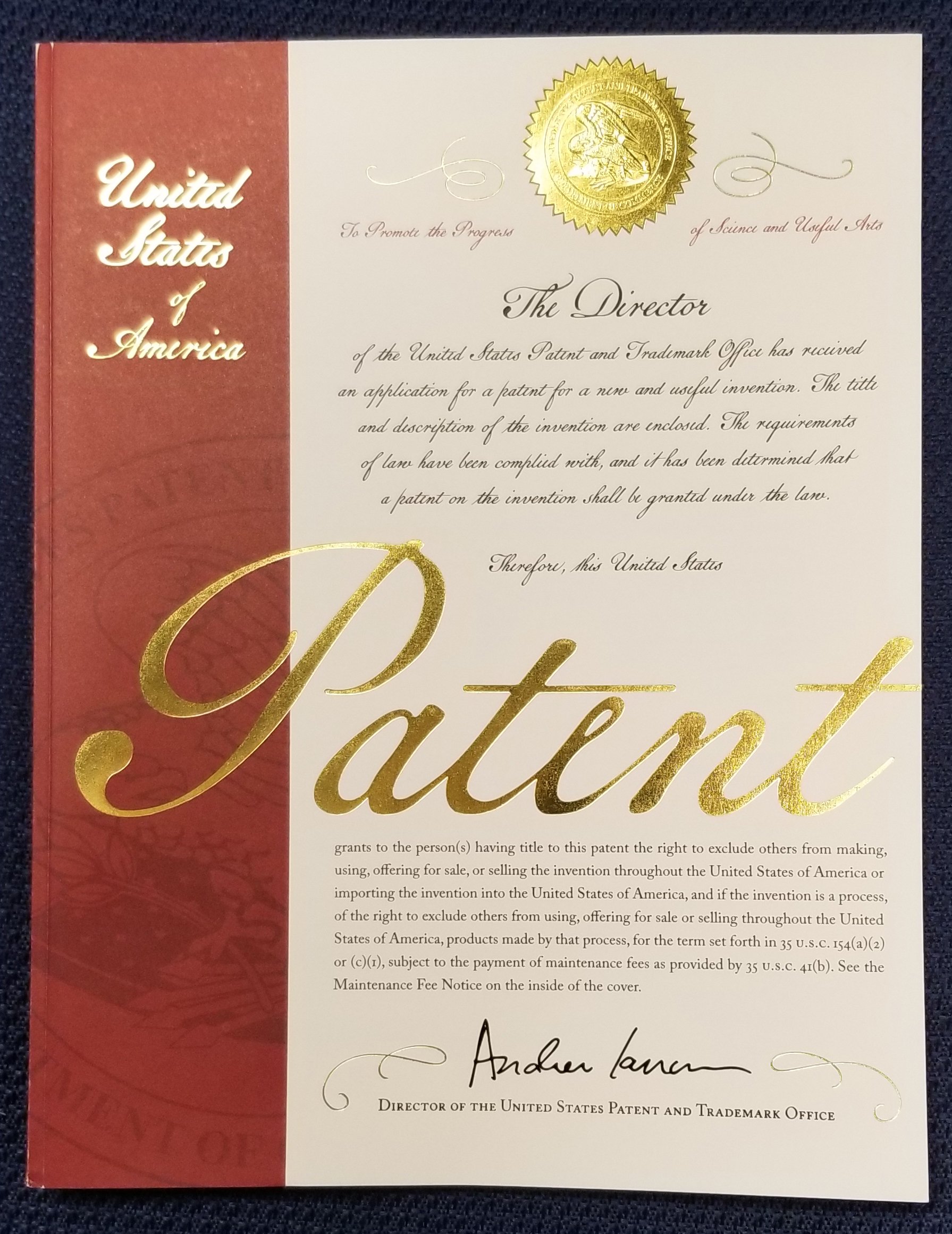
FarSounder Received Its 8th Patent
FarSounder, the leading developer of 3D Forward Looking Navigation Sonars, has expanded its IP portfolio with the issuance of its 8th Patent, number 11,609,316. This US patent expands the company’s patent portfolio for its unique sonar system and its 3D processing.

3D Forward Looking Sonar with FarSounder CEO, Matthew Zimmerman - Podcast S2E3
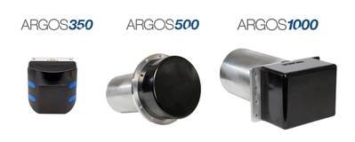
We are learning about some seriously important technology in this one! FarSounder is leading the industry with their latest 3D forward looking sonar products. Now with the Argos350, more recreational boaters can utilize this technology that allows captains to see what is in front of their vessel in real time.
Unmanned Surface Vessels Growing Need For Underwater Obstacle Avoidance
As missions expand to long duration coastal monitoring, security patrols in austere ports, force projection into higher latitudes, ship-to-shore wayfinding, and high speed interdiction, consideration of underwater navigation hazards is becoming a priority for USV many operators.
How the Yachting Community can help charting the Planet’s Seabed
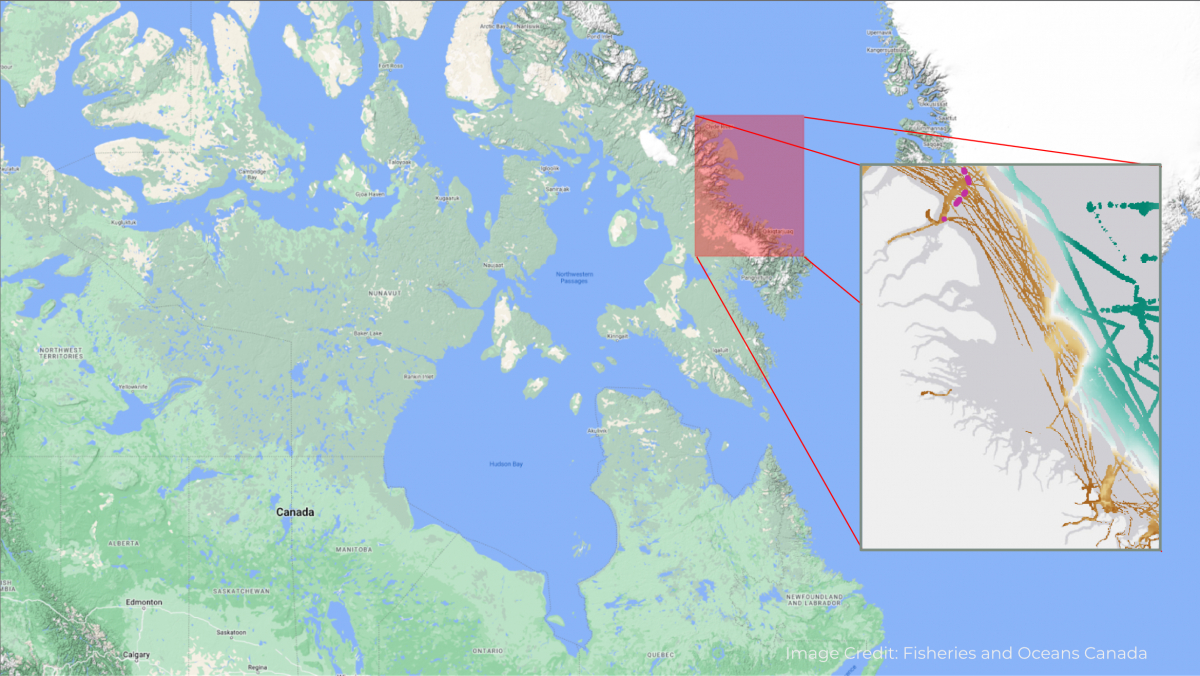
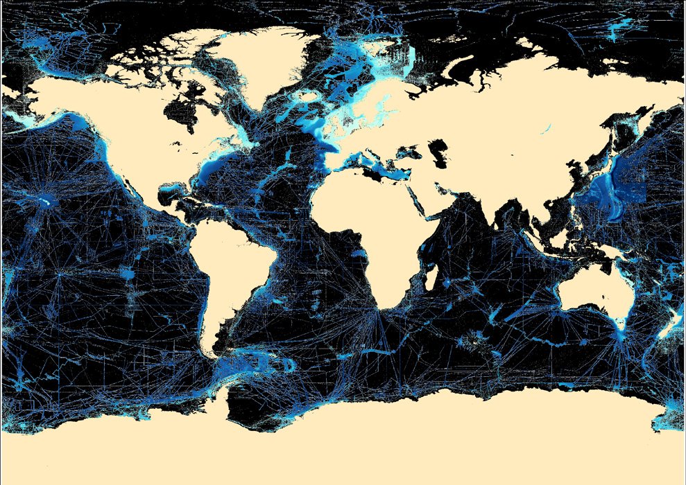
One allure of yachting for many owners and guests (and even crew) is the adventure of cruising through pristine waters and voyaging to some of the most exclusive locations in the world. Exploration into the unknown allows us to be immersed in the unspoiled beauty of our marine world. According to Seabed 2030 (a global initiative to map the world’s oceans by 2030), we’ve mapped less than 24% of the world’s sea floor. “We know the topography of the Moon and Mars in greater detail than that of our own planet.”
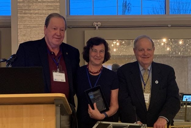
FarSounder's Cheryl M Zimmerman Receives MOTN Leadership Award
FarSounder’s Chairman of the Board, Cheryl M. Zimmerman, has been honored with the Marine and Oceanographic Technology Network’s (MOTN) Annual Steve Withrow Award.
Turkish USV’s integrated with FarSounder’s Argos Forward Looking Sonar
FarSounder Argos 3D Forward Looking Navigation Sonars have been included in the navigation control system for two Unmanned Surface Vessels (USV) built in Türkiye.
When safe navigation becomes passive research
A common misconception when looking at a large-scale chart is that there is a reliable level of resolution on the seafloor. According to Seabed 2030, less than 25 percent of the world's oceans have been surveyed at all, and much of this only at 100m resolution.
What Lies Ahead
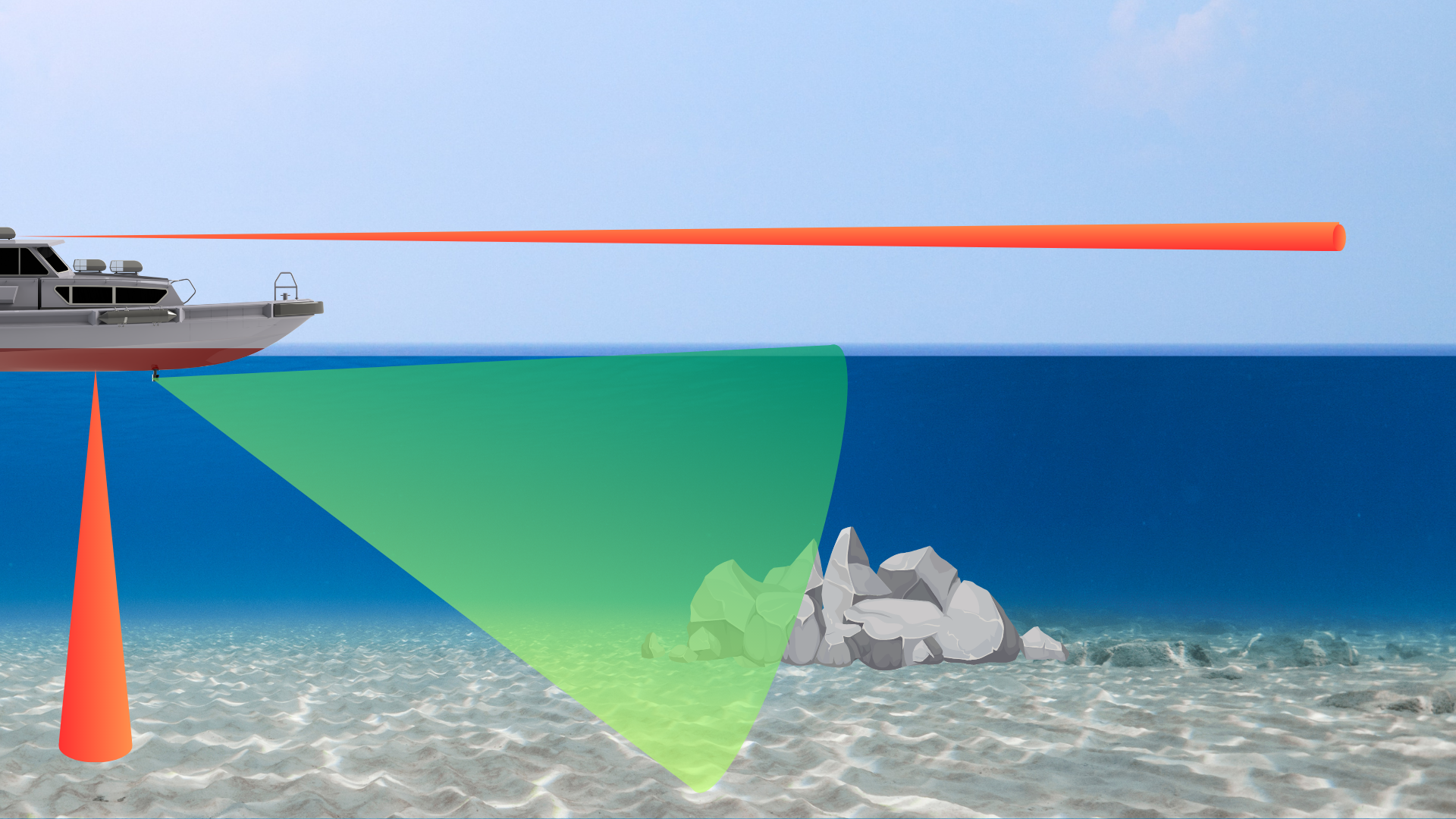
Imagine operating your boat by only looking in a rear-view mirror, while someone tells you what’s in front of you. Sound a bit challenging? Well, as far as anything under the water is concerned, this is exactly how most boaters do it.
Mapping our Ocean with the help of superyachts
For many owners and guests, the allure of yachting is the adventure of cruising through pristine waters and voyaging to some of the most exclusive locations in the world. These unique experiences stem from a fundamental urge to explore our world and see its beauty.
Yachting Contributions to Global Community
For many, yachting’s allure is the adventure of voyaging to some of the most exclusive locations in the world. This means venturing into the unknown.
Innovative Enhancements to FarSounder’s Local History Mapping
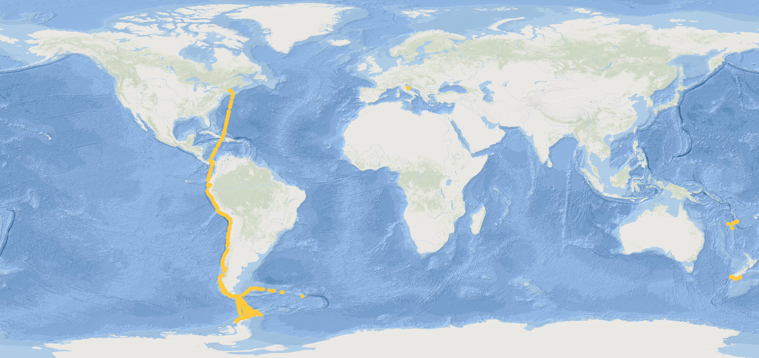
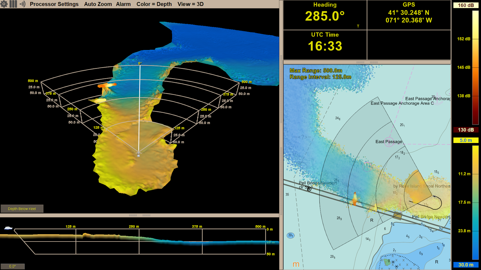
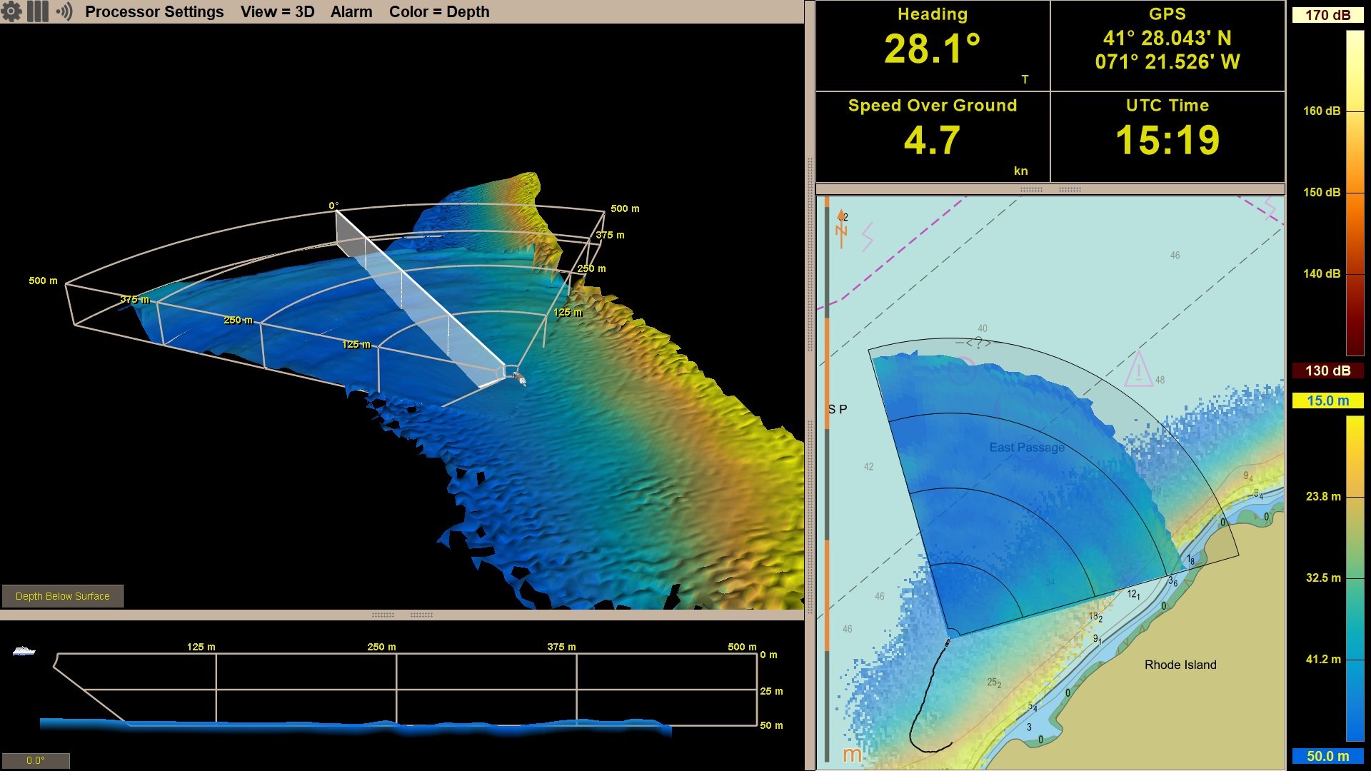
FarSounder has announced new enhancements to their SonaSoft™ Software featuring an expansion of their Local History Mapping™ (LHM) application. All models of the Argos™ Forward Looking Sonar system now have the ability to recall unlimited user collected data (limited only by amount of available hard drive space). LHM is an advanced, innovative software feature that allows users to generate a map of the seafloor as they navigate.
Confident Cruising
Groundings and collisions cost lives and money and have significant environmental impacts. What is ahead of the vessel and underwater is the most essential navigation information that can mitigate a dangerous situation. The best prevention is to have a suite of tools working together to provide you the most information possible allowing for heightened situational awareness.
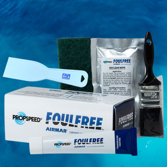
FarSounder Partners with Propspeed for Biofouling Solution
FarSounder has approved Propspeed FoulFree as an acceptable coating for the Argos sonar array face to limit biofouling. As a result, the companies have come together to offer the first application of FoulFree at no charge with each new Argos purchase.

FarSounder’s Sonar Cable Advance Program
FarSounder has implemented the Sonar Cable Advance Program. They are offering advance delivery of their wet-mateable sonar connection cables at no charge for any qualified new build project. This program reduces the cost of installing an Argos Sonar and will make it easier for the owner's team to include the sonar system when they are selecting the rest of the navigation electronics.

FarSounder Announces European Patent
FarSounder, the leader in 3D forward looking sonar, is pleased to announce the issue of their first European Patent.
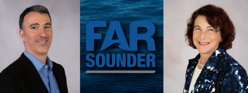
FarSounder Announces Leadership Changes
Matthew Zimmerman, the company’s former Executive Vice President of Engineering, is taking the helm as Chief Executive Officer (CEO). Their former CEO, Cheryl M. Zimmerman, is continuing her role as Chairman of the Board as well as taking on the position of Market Development Strategist.
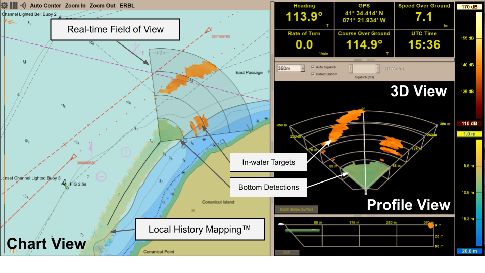
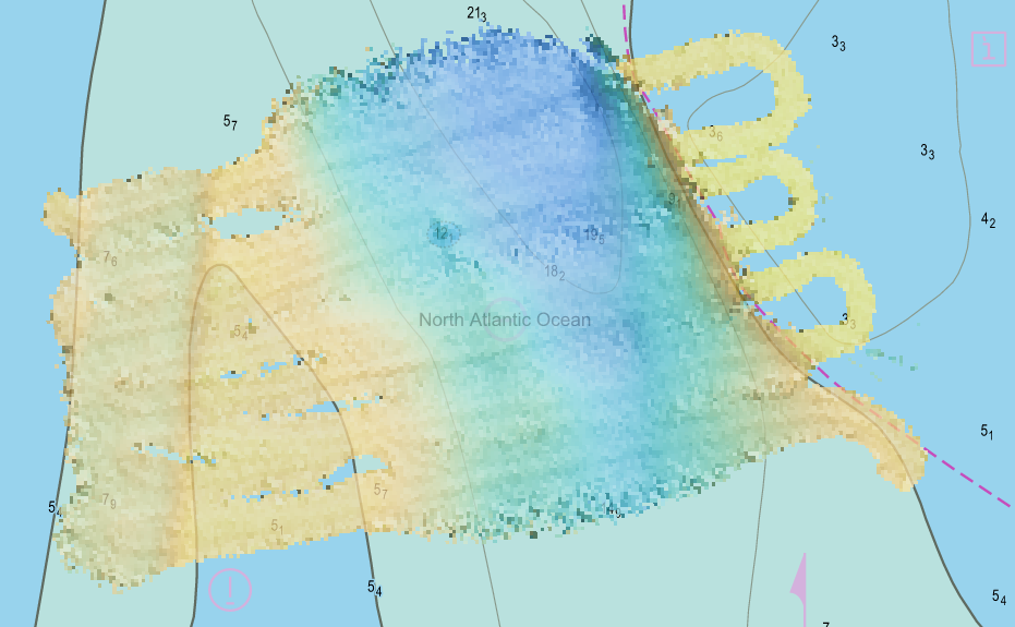
Mapping the Sea Floor - Innovations in Forward Looking Sonar
All Argos FLS systems use FarSounder’s SonaSoft™ software for processing and displaying data. Its main function is to view real-time data in the path of the vessel. In addition to detecting the seafloor and hazards ahead in real-time, it also has a unique application called Local History Mapping™. The application stores this data for use as additional information to supplement older chart data.
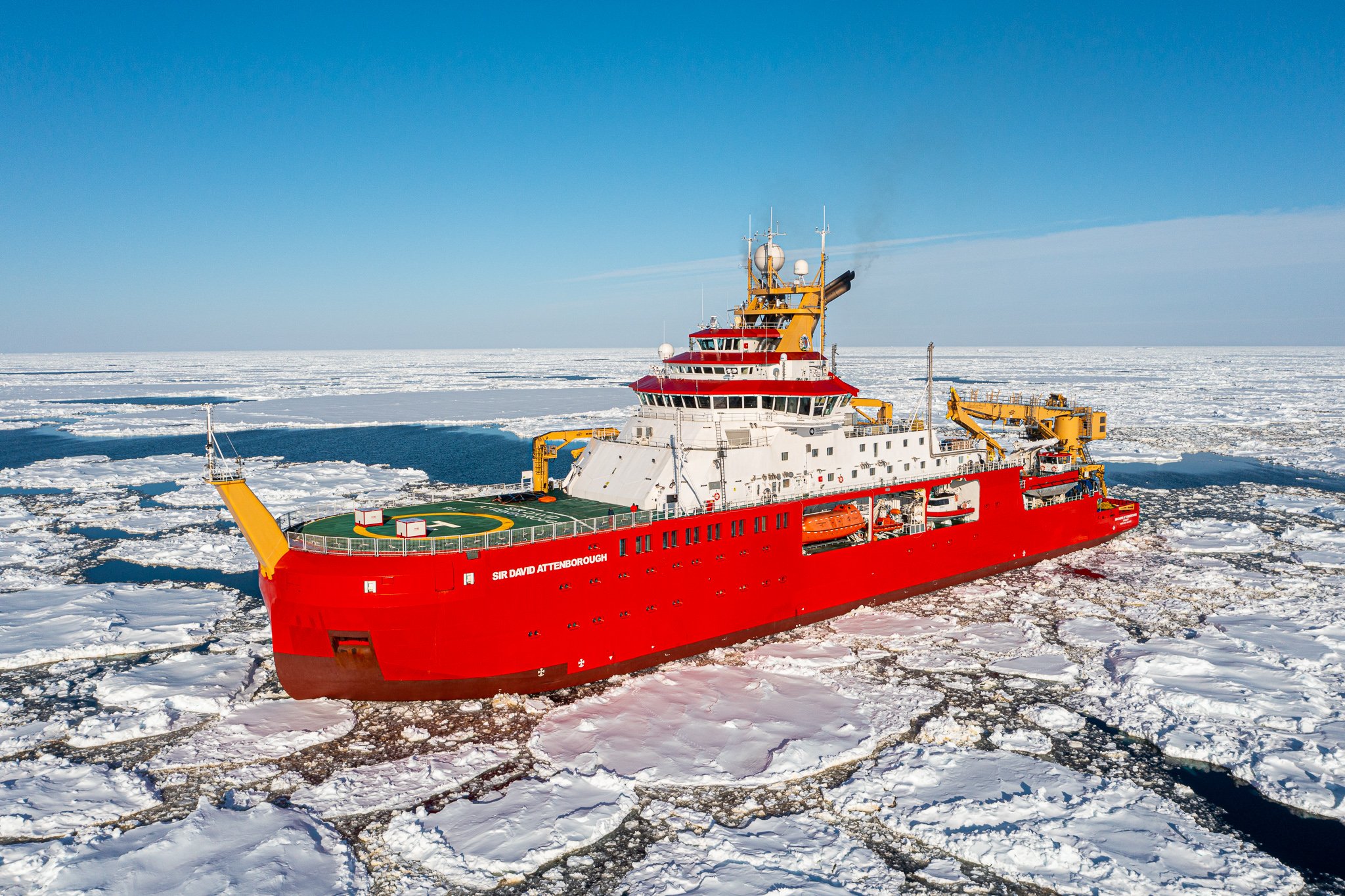
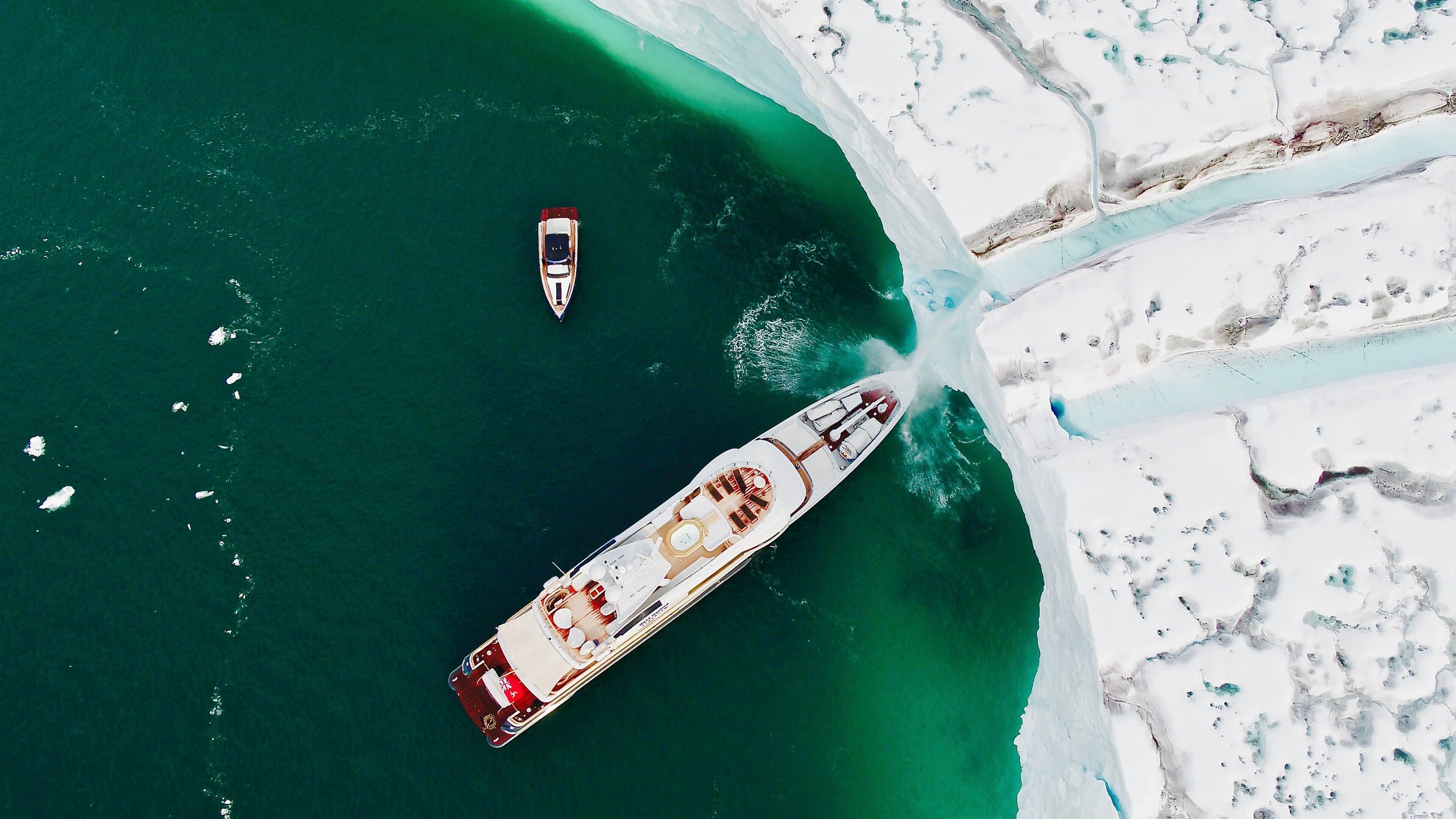
RRS Sir David Attenborough Completes Ice Trials
The RRS Sir David Attenborough, equipped with FarSounders Forward-Looking Sonar, completes ice trials during its maiden voyage to Antarctica – a critical milestone in the commissioning of Britain’s new polar ship.

Update for Argos: Software Collaboration Enhances Forward-Looking Sonar
On the evergoing journey to protect the ecosystem and keep vessels and passengers safe, FarSounder and Navtor are making and impact. They share the same core goals of improving ocean safety through innovation and technology while simultaneously keeping the focus on the customer.
Farsounder Recommends Propspeed FoulFree for Sonar Transducers
Propspeed, an innovator of underwater foul-release coatings, received an endorsement from FarSounder, a pioneer in navigation and obstacle avoidance systems, which has tested the Propspeed Foulfree foul-release coating and recommends it for application by their customers, dealers and partner shipyards.