Tech Blog
Search our Tech Blog:

New Navigation Techniques for Arctic Exploration
In today’s world of instant communications, constant connectivity, and virtual reality, it is easy to forget that there are still vast expanses of our world that are undiscovered and unknown. Polar regions make up much of that vast unknown. Yet in the past few years, the number of vessel excursions into these areas is increasing steeply. Shipping, tourism, oil exploration, science, and EEZ expansion are all driving this surge. With this surge comes increased risk of navigational hazards as many of the “classic” navigation tools (recent surveys, stable buoys and channel markers, and good gps coverage) are not available or practical in these areas.

Applications of Navigation Sonar Related to Ice
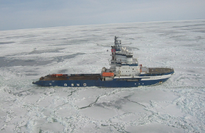
Navigation in and around ice is a very important topic for vessels destined for the arctic or antarctic waters. The rise of adventure cruising, scientific expeditions, and commercial shipping through these areas is keeping the topic in the forefront of many conversations. Ship operators in these areas are interested not only in detecting and avoiding icebergs but in some cases also knowing how close they can get to ice that is clearly visible above the water. Navigation in such areas is clearly reliant on seaman experience. Since the sinking of the RMS Titanic, engineers around the world have been working on ways to detect icebergs using various sonar technologies. In this blog post, we summarize how FarSounder's 3D sonars can be used to navigate in sea ice conditions and how our obstacle avoidance sonars can be installed on ice classed vessels.
